
Balancing Growth & Conservation on North Carolina’s Coast
Destination by Design developed Imagine Currituck to provide a framework for land use and development that would update and refine policies set forth in the county's 2006 Land Use Plan while engaging the public.
Coastal Currituck County, in the North Carolina Outer Banks, is experiencing unprecedented growth, shifting demographics, and increasing opportunities for new development- all factors contributing to the need for a land use plan that would incorporate citizen ideas regarding the changing physical and demographic landscape.

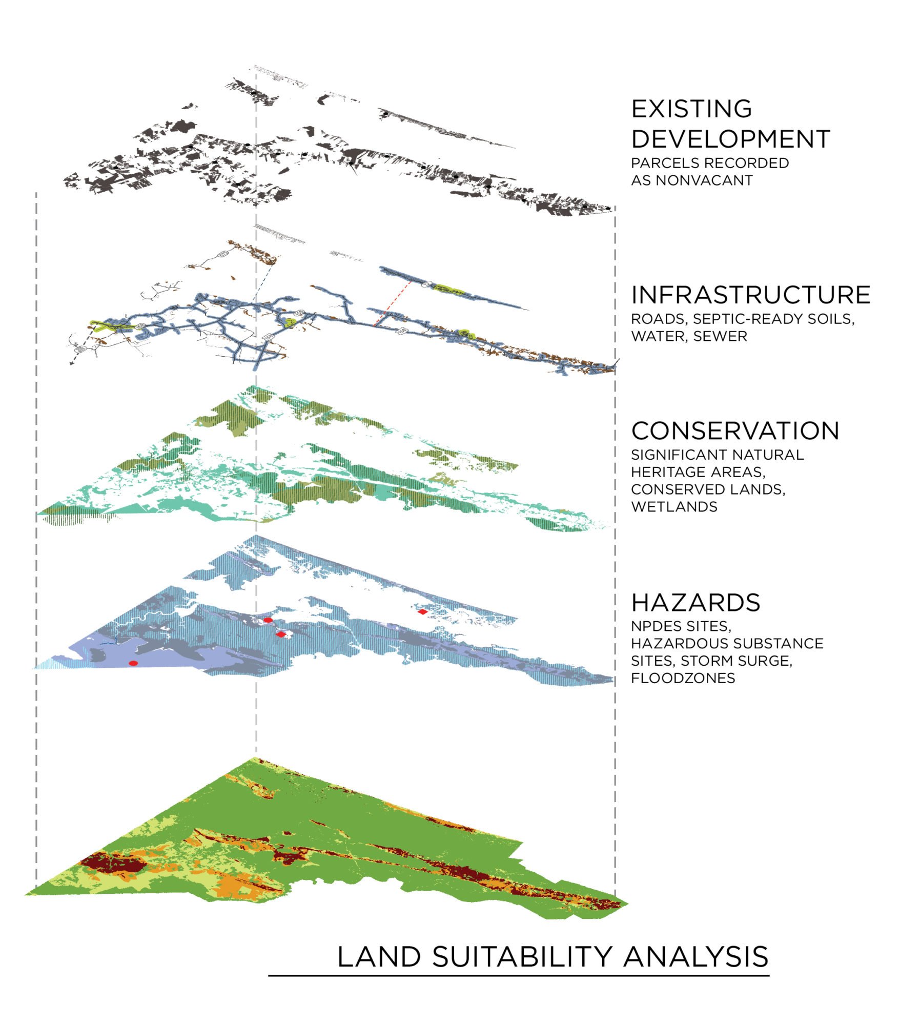
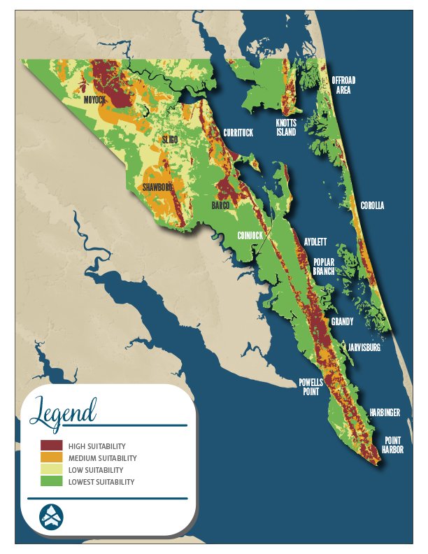
Land Suitability Analysis
The Land Suitability Analysis (LSA) identifies key areas most suitable for development, while highlighting vital areas for conservation.
Planning Goals
WORKING TOGETHER. Engage citizens in a meaningful way through a participatory planning process.
STAY ON TARGET. Identify areas appropriate for varying densities of growth to maximize existing infrastructure and the preservation of rural landscapes and sensitive natural areas.
MAKE IT VISUAL. Produce a plan that is visually compelling and illustrates opportunities for growth and conservation.
KEEP IT REAL. Establish realistic priorities and specific steps for achieving plan recommendations.
Public Engagement and Guiding Principles
The Currituck County Board of Commissioners appointed a 12-member Imagine Currituck Steering Committee with representation from across the County to guide plan preparation and provide local perspective and insight. The Steering Committee was highly effective in soliciting public engagement via the online tools and workshops.
The Committee received technical and administrative assistance from County planning staff and the planning consultant team. The Commissioners supported the Committee by providing leadership and direction at strategic benchmarks during plan development.
Tools of Engagement

Website & Blog
A project website served as the portal for regular blog posts, project updates, and discussions on plan-related topics. Additionally, the site featured an informational video and key demographic data. The website also housed essential public engagement tools: the online survey and interactive map.
Survey
An online questionnaire provided an opportunity to collect citizen opinion on a variety of planning topics and community preferences. The survey was a tremendous success with 1,790 responses. Paper copies of the survey were made available at the County’s senior centers.
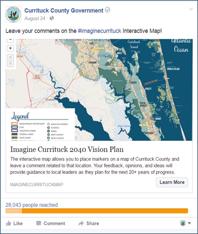
Interactive map
A custom interactive map of the County allowed respondents to identify map markers as “ideas, insights, or barriers.” Participant comments were provided and associated with each marker. The map proved effective, resulting in the collection of 134 location-specific comments.
Social Media
Facebook and Twitter were used to publish and promote the video, blog, survey, and interactive map. Paid Facebook advertising helped to reach over 28,000 residents and property owners, and resulted in observable spikes in survey responses.
Public Engagement Video
The Imagine Currituck promotional video included dramatic aerial views of the County and highlighted the key planning themes.
This video was promoted on Facebook and supported a “call to action” for citizens to engage in the plan development process.
Marshland Boardwalk along the Currituck Sound
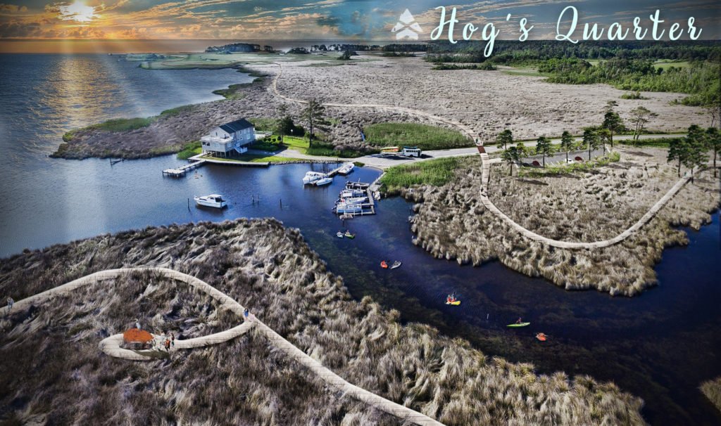
A long-distance pedestrian boardwalk system through marshland along the Currituck Sound would provide a destination-quality recreation amenity for locals and visitors.
The addition of paddle-accessible camping platforms connected by the boardwalk would expand opportunities for overnight stay along the Currituck Sound and provide a significant attraction for outdoor recreation tourists.
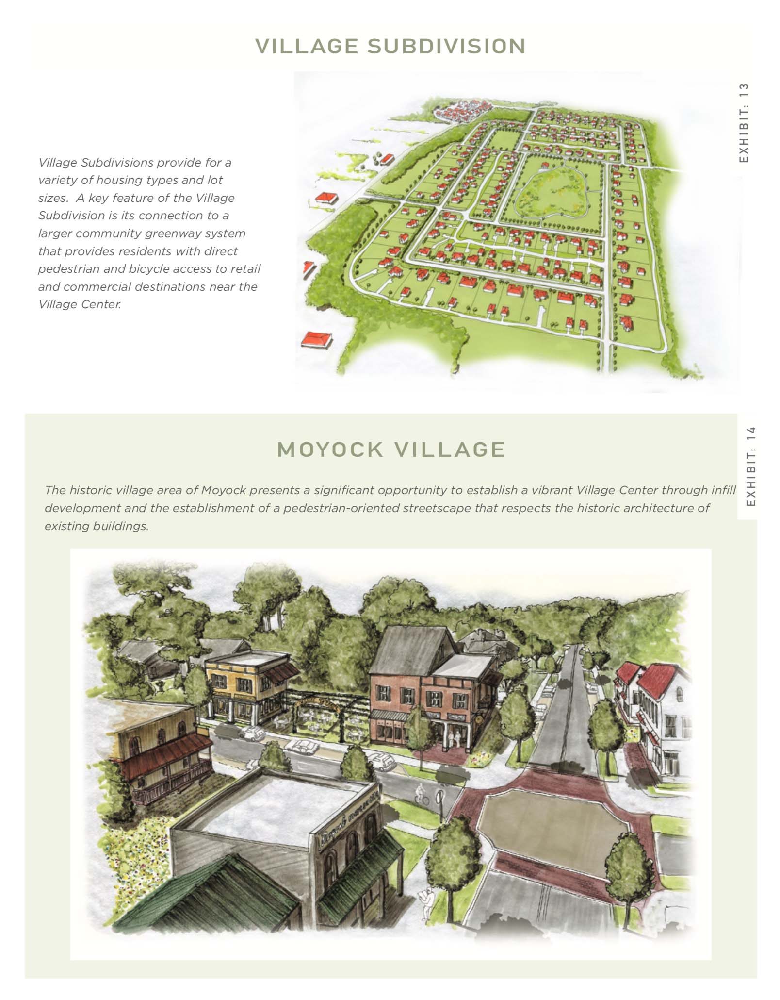
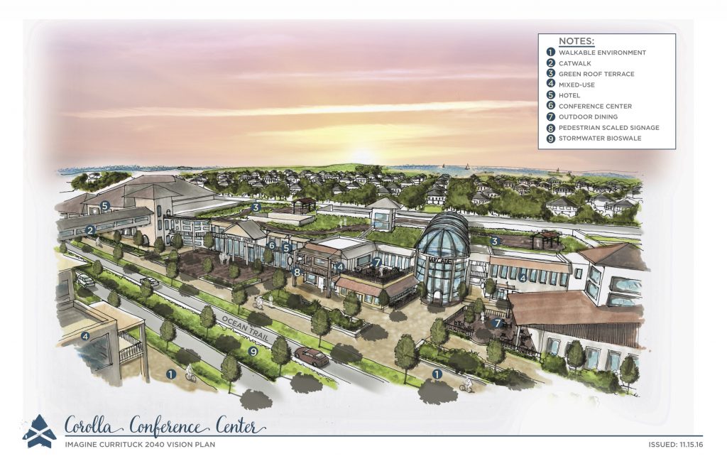
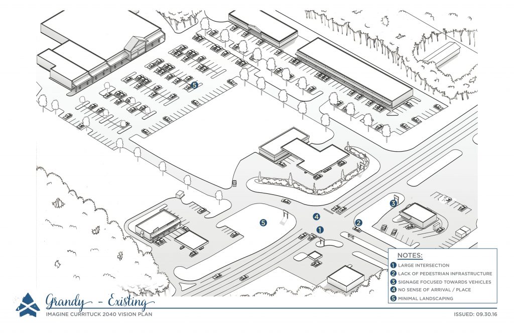
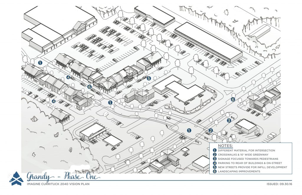
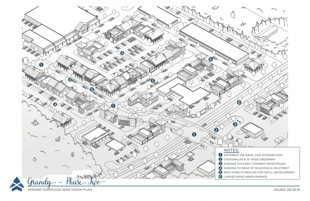
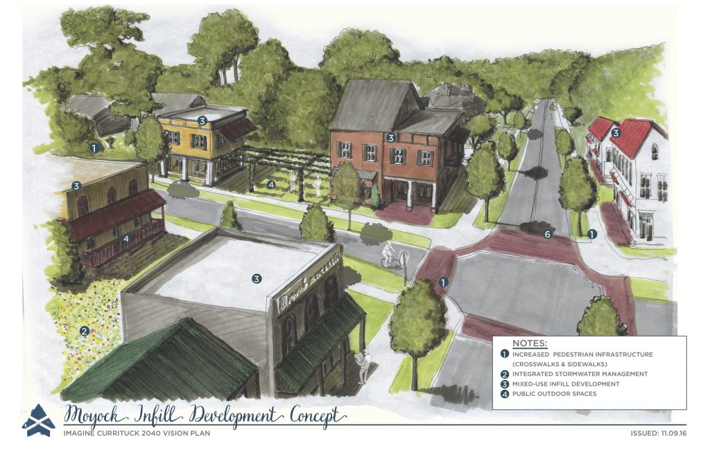
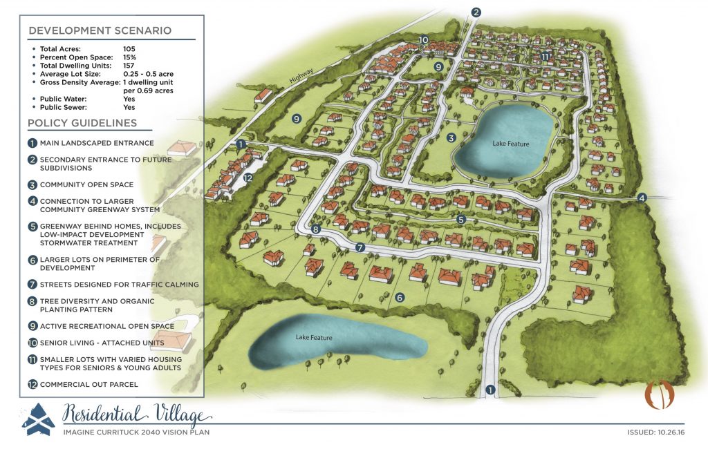
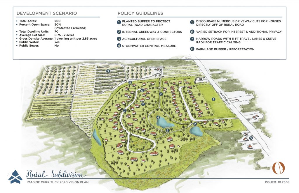
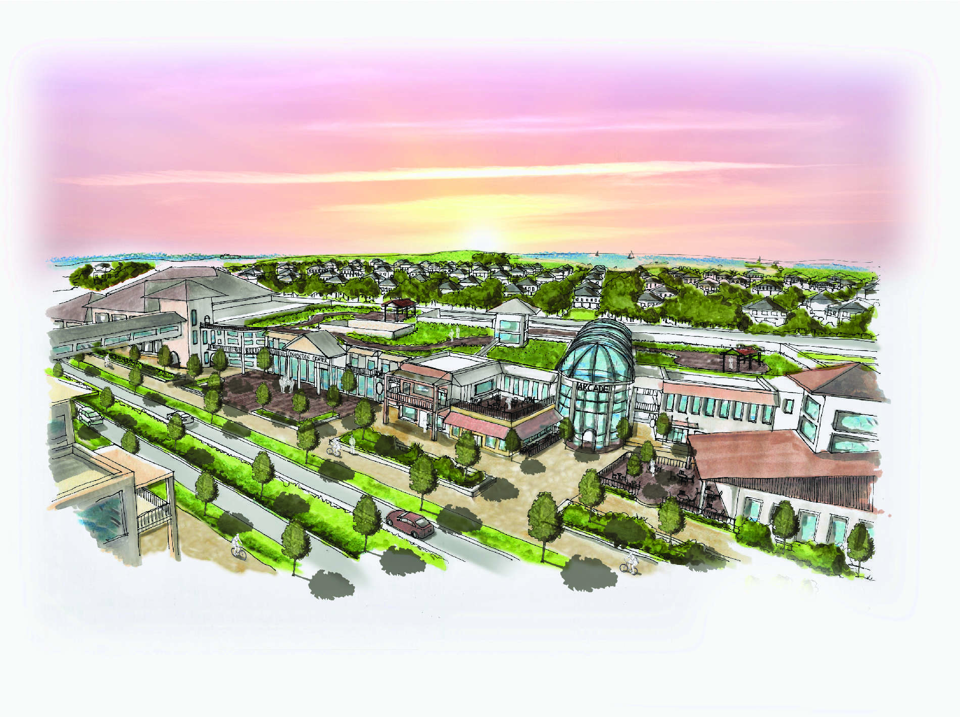
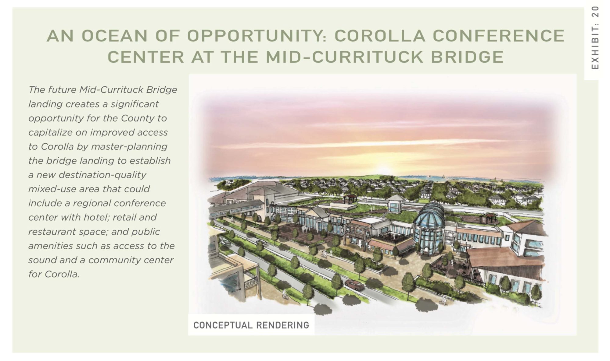
Project Renderings