Establishing a National Historic Trail
A multi-jurisdictional master planning process to establish a multi-use National Historic Trail from the Abington, VA to the Kings Mountain State Park in South Carolina.
DbD collaborated with multiple government partners and private landowners to establish a plan for the Overmountain Victory National Historic Trail that honors the past and respects the vision for the future.
“Turning of the Tide” in the American Revolution
The Appalachia Region of the United States is steeped in history, namely in the form of Civil War-era historic sites that dot the region. It was a much earlier battle, however, that truly cemented the region’s place in the history books.
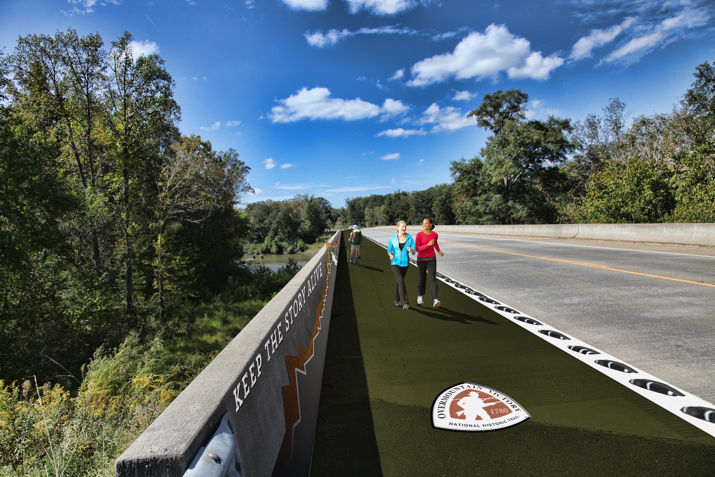
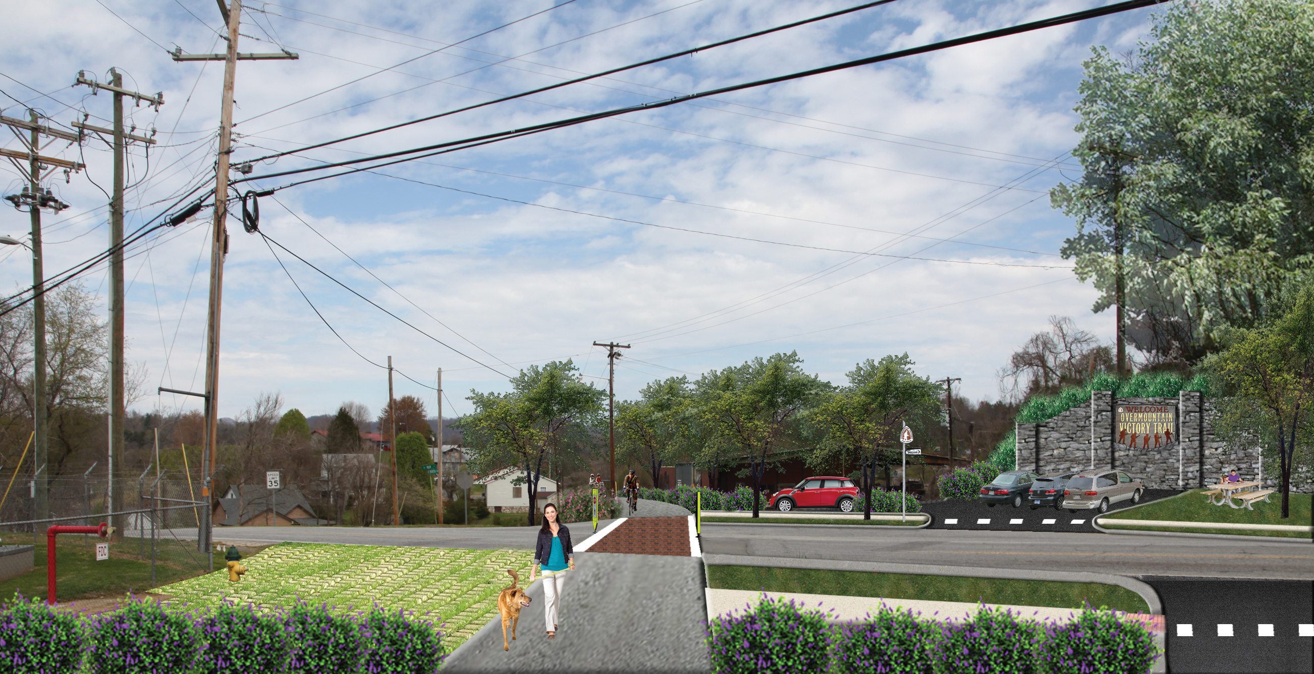
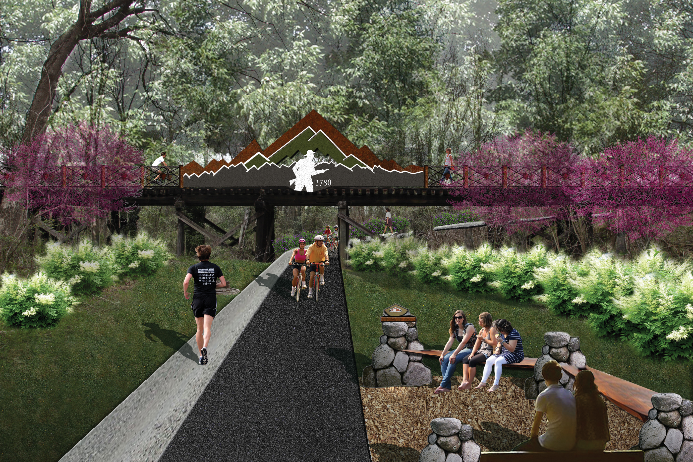
In 1780, a 330-mile route stretching from Virginia to South Carolina was traversed by a rag-tag group of common folk in the Patriot militia who were on a mission to face down a larger contingent of British-led loyalists during the American Revolutionary War. The Patriots notched a decisive victory in the battle fought near Kings Mountain State Park in South Carolina and contributed to changing the course of American history.
A century after this battle was waged, the U.S. Congress designated the route marched by the Patriot militia as the Overmountain Victory National Historic Trail (OVNHT)—the first trail with a National Trail designation. However, the majority of the 330-miles that delineate the historic route remains undeveloped today.
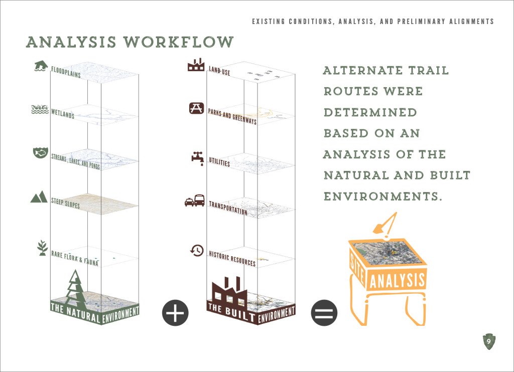
How do you build a trail and greenway system that can fundamentally improve the economic well-being of the communities and people that live along this historic route? How can we effectively approach landowners about the creation of a public trail? These were the questions DbD set out to answer with each OVNHT project.
Engaging Landowners
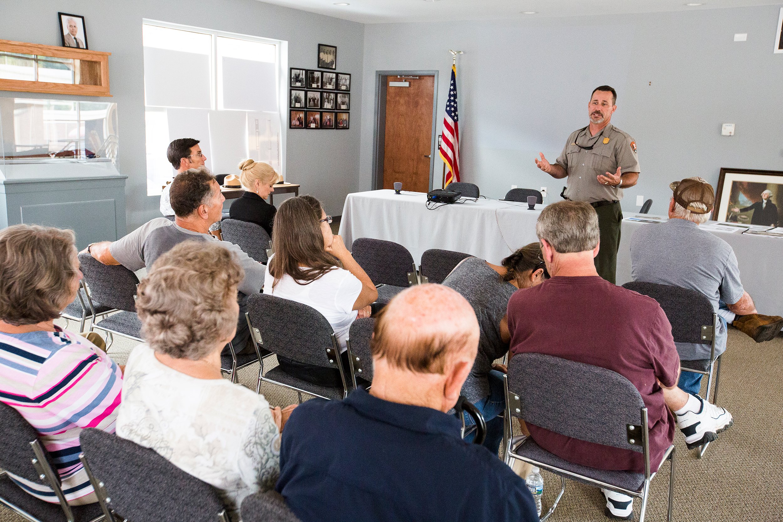
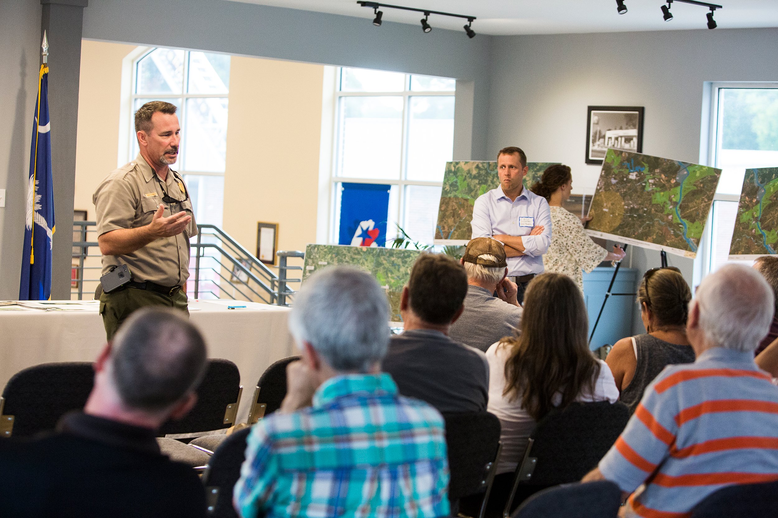
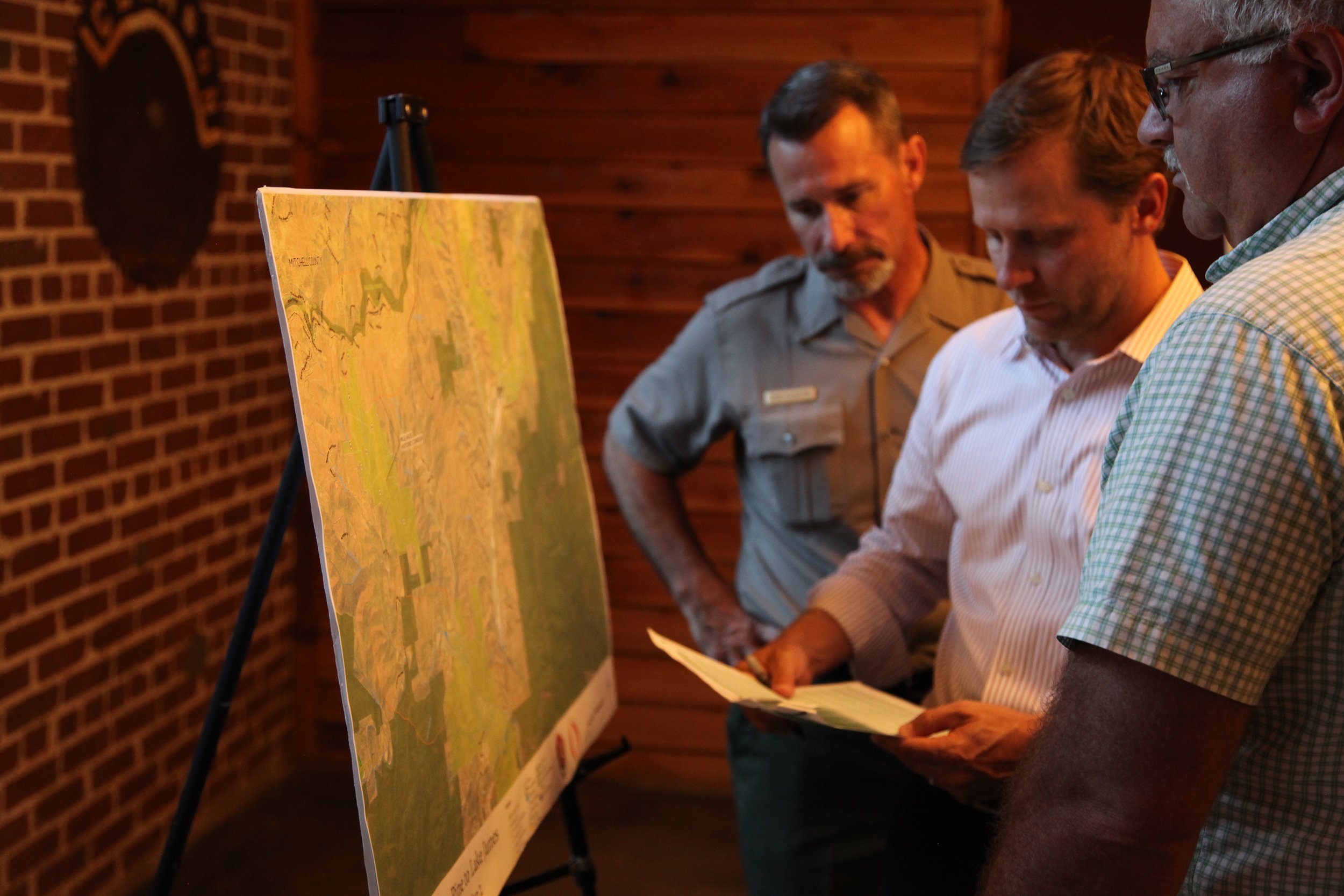
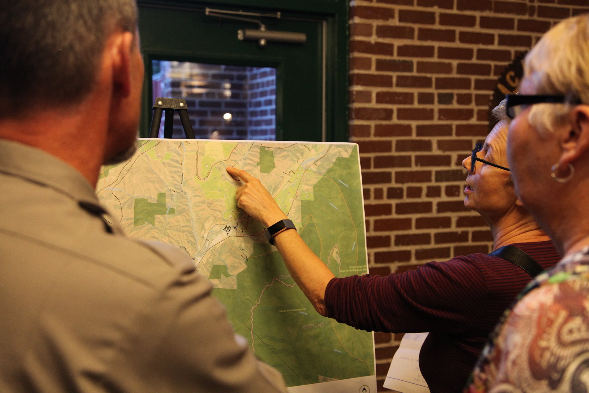
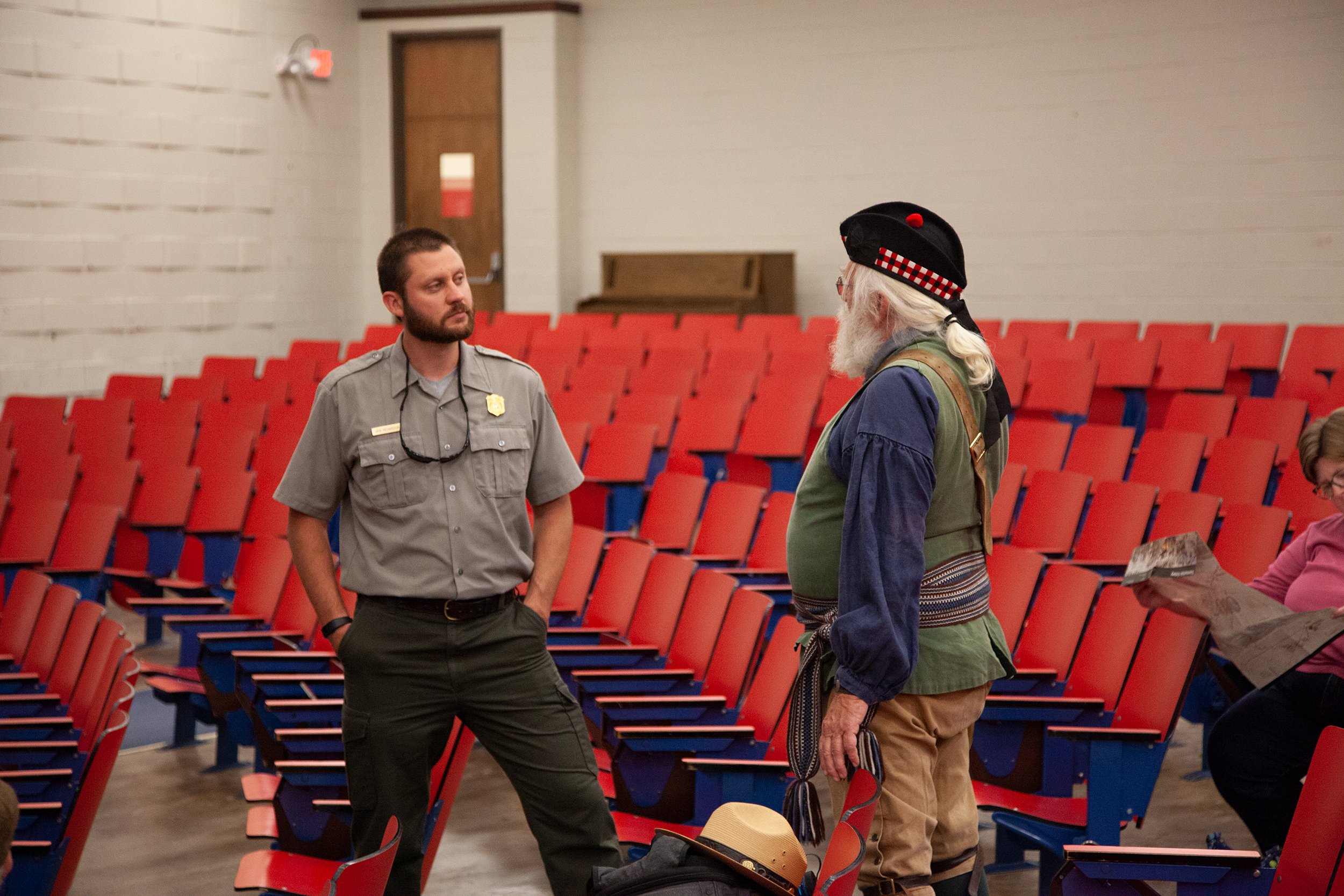
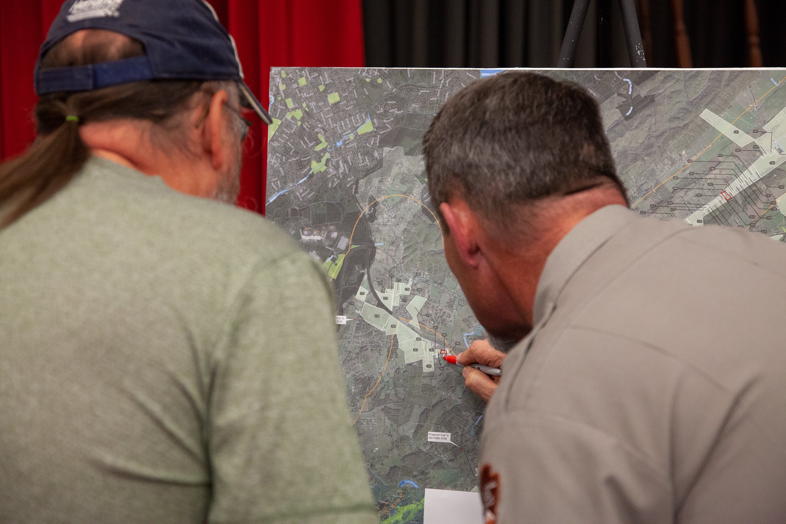
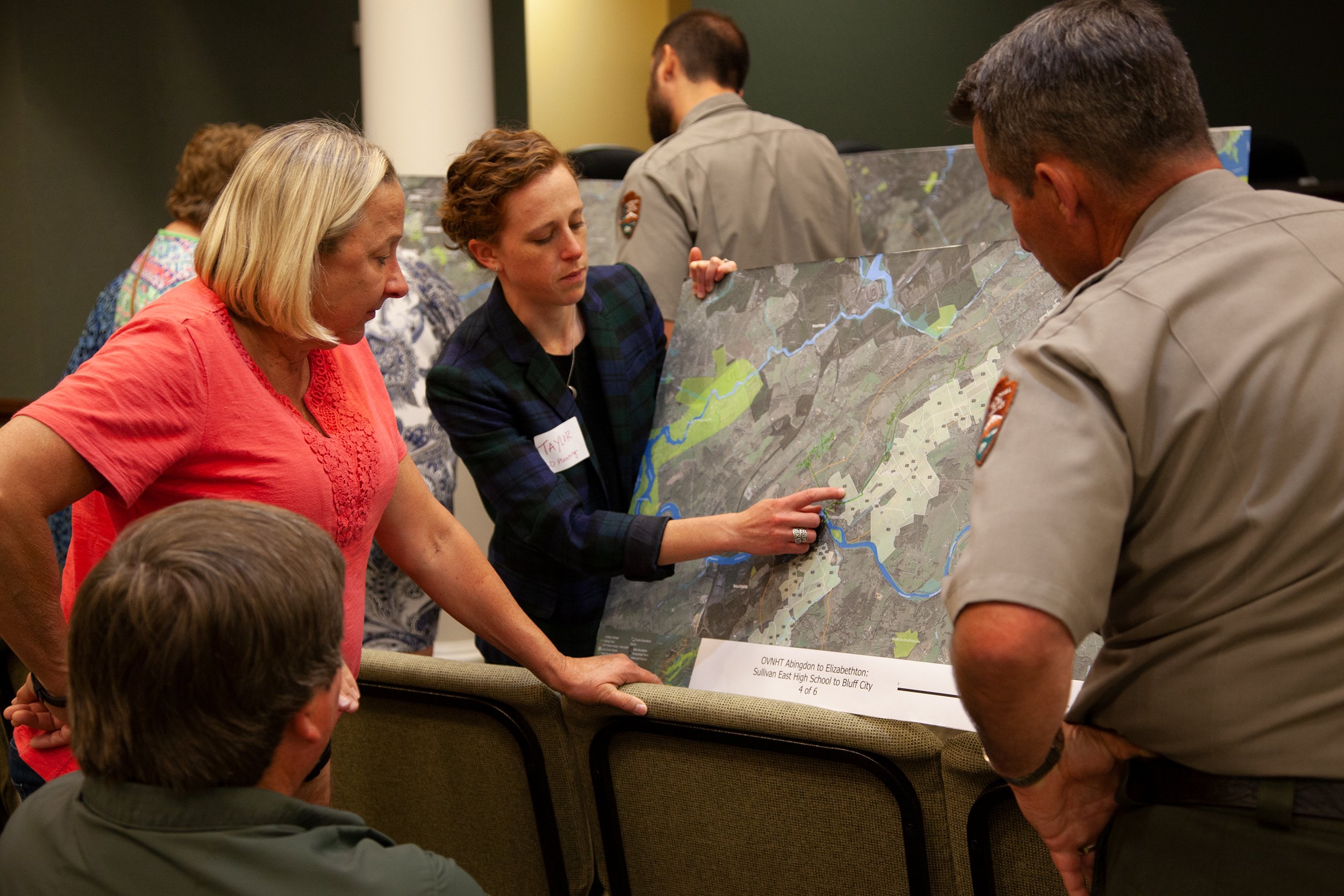
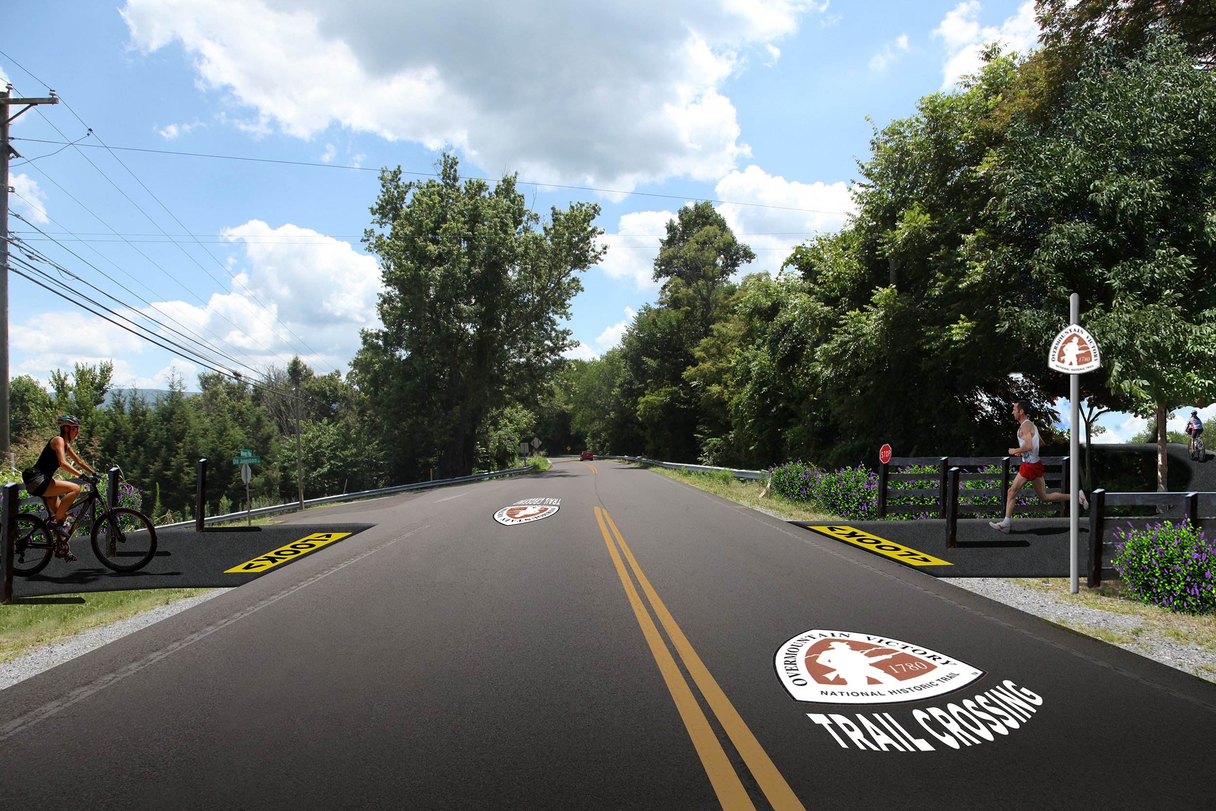
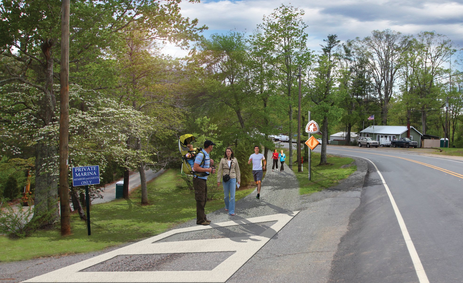
A large portion of the work we did in the OVNHT planning process involved reaching out to landowners in the path of the OVNHT to brief them on the trail’s planned route. Landowners were engaged through the creation and dissemination of custom-produced videos, informational letters, and public meetings.


Bringing the Story to Life with Video
Each section of the OVNHT includes a custom-produced outreach video for affected landowners. The video helps explain the historical significance of the trail and the role that the landowners can play in preserving this piece of American history. In addition to the outreach video, a series of meetings provided an opportunity for landowners along the route to get their questions answered and learn how they can partner to help create the trail.
A Custom Video for Each Planning Section
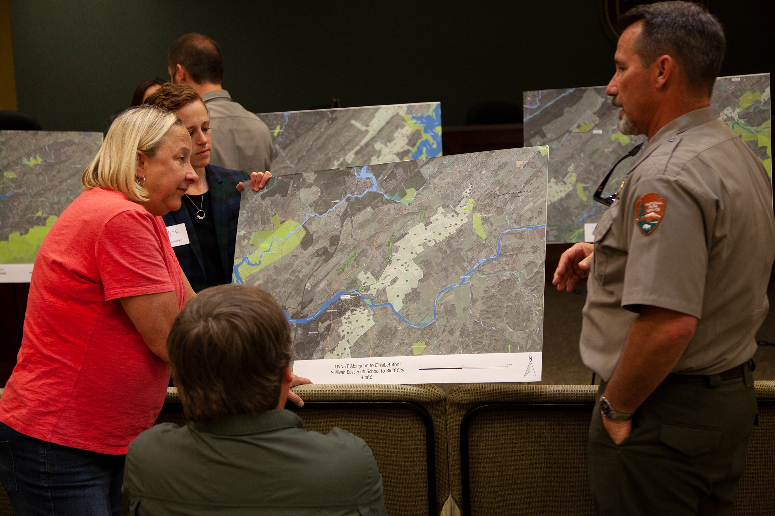
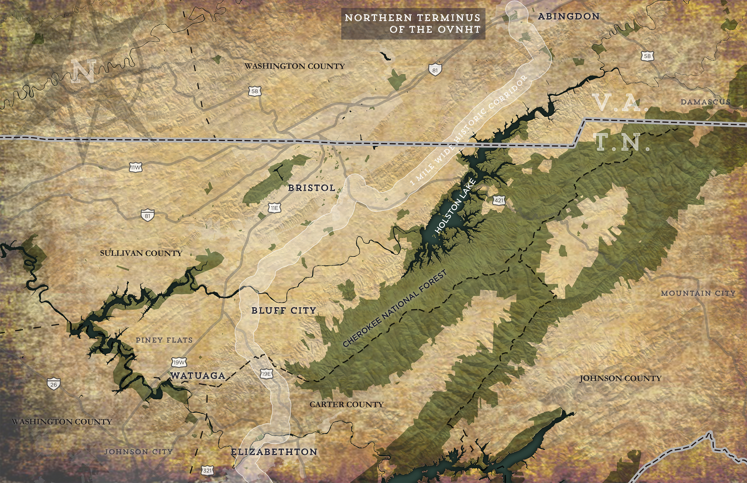
SECTION 1: Abingdon to Elizabethton
This segment of the OVNHT begins at its northern terminus in Abingdon, VA and ends at the future site of the Gap Creek Park in Elizabethton, TN. The 93-mile stretch of trail will connect multiple jurisdictions from Virginia to Tennessee, offering a rare level of cross-state trail connectivity.
The long stretch of trail will offer ancillary development opportunities in many of the communities that it touches. For example, the Sullivan County Schools (TN) system and Planning Department plan to pursue the development of a trailhead and 15-acre public park adjacent to the County’s new middle school. This planned development will offer a unique learning environment for local students and other area residents who will gain a greater appreciation for the historic role their small town played in the American Revolutionary War. The trail’s planned connection to Sullivan County’s Observation Knob Park on the shores of beautiful South Holston Lake is another example of how this stretch of the OVNHT can complement existing assets and take a community’s tourism portfolio to the next level.
Read the Abingdon to Elizabethton Section Plan


SECTION 4: Lake James to Morganton Section
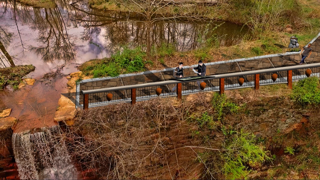
The Lake James to Morganton section of the OVNHT is notable in the seamless connectivity it provides to a region ideally suited for increased trail connectivity. Both Burke County and the City of Morganton are blessed with an array of public parks, greenways, and river access points that would benefit from the increased connectivity that the OVNHT would bring to the area. The 20-mile section of trail will bring improved access to Lake James, Freedom Park, Catawba Meadows Park, and the historically significant McDowell House.
The McDowell House played a pivotal role in the attack on the British at the Battle of Kings Mountain, serving as a site of significant strategic planning by the Overmountain Men before they attacked British loyalists. The house is used as a staging ground to this day by OVNHT re-enactors who commemorate the role the property played in ensuring victory for the Overmountain Men.

Read the Lake James to Morganton Section Plan

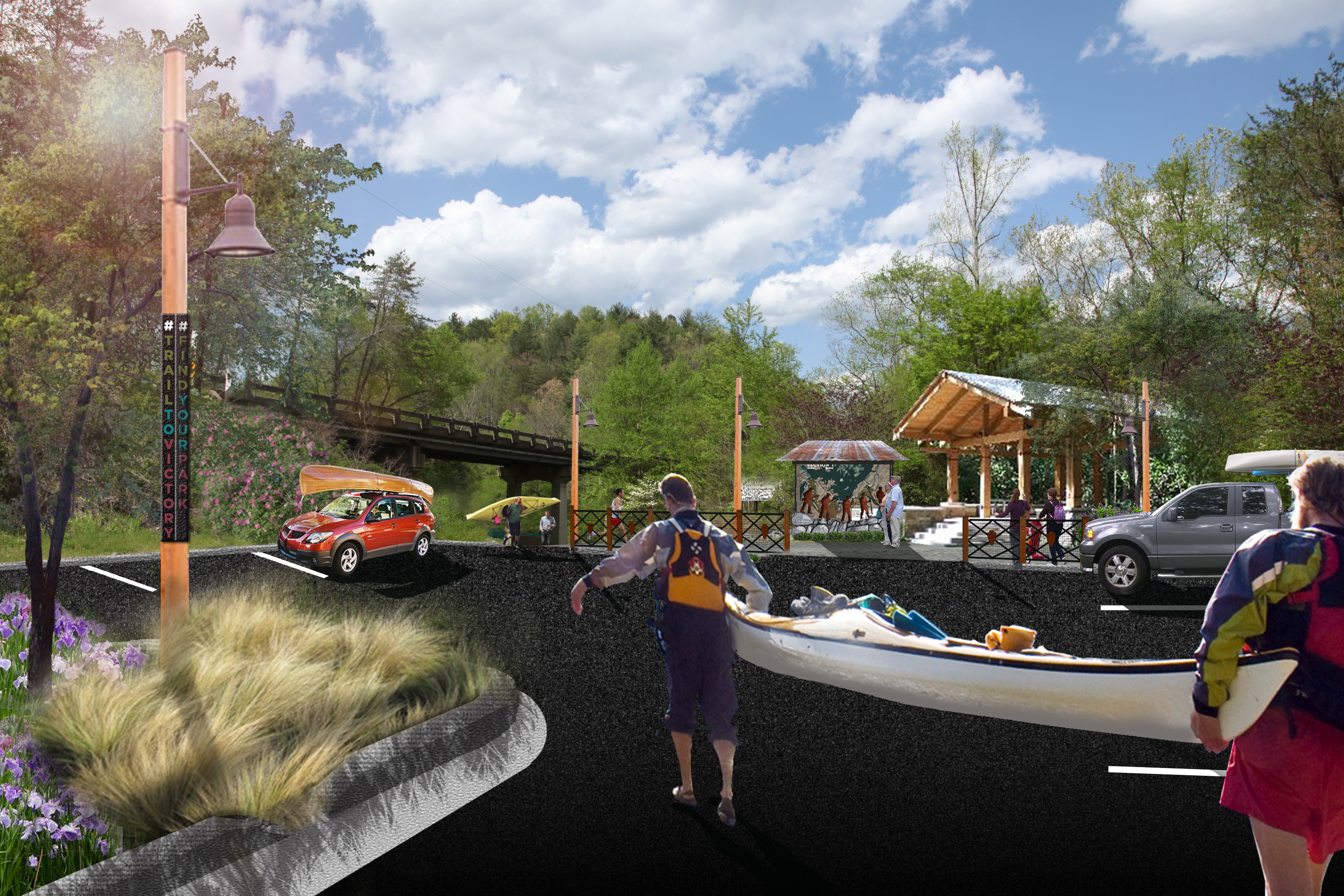
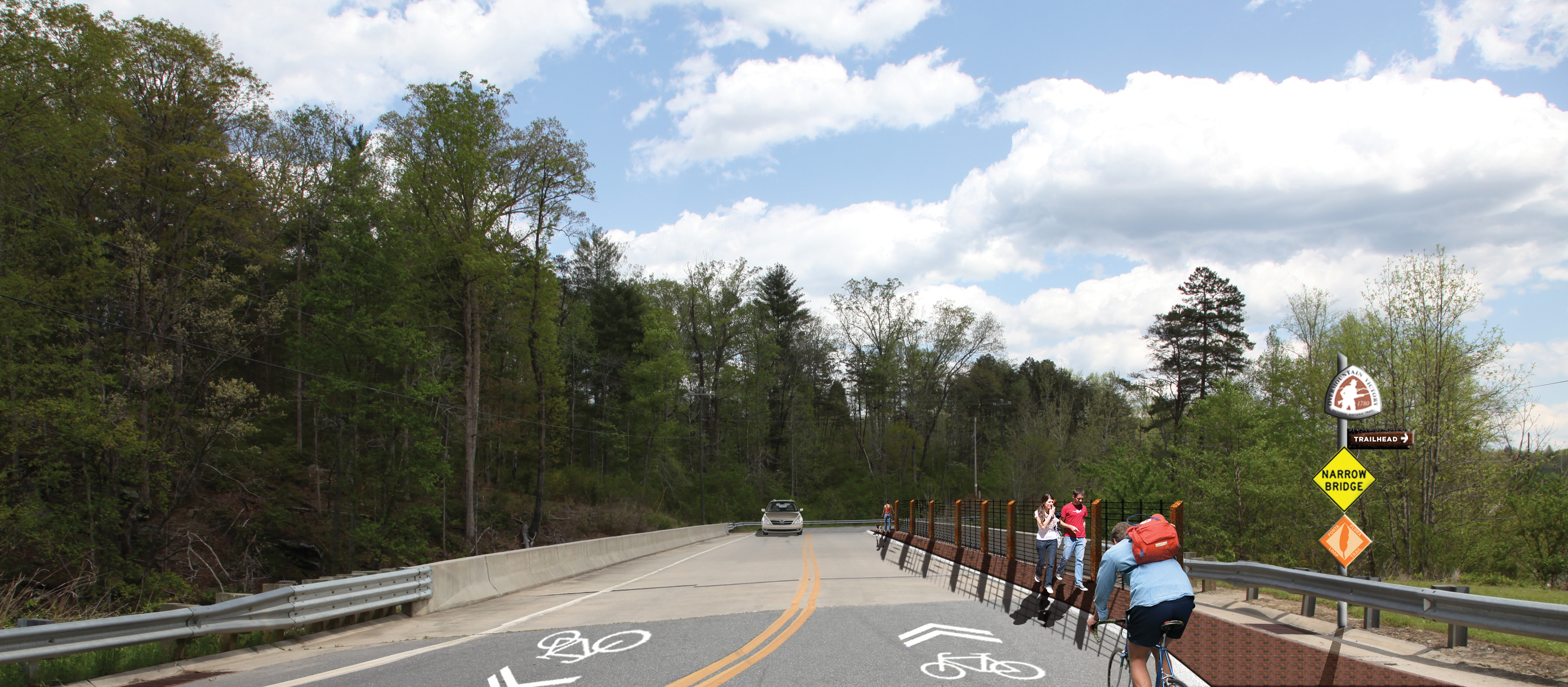
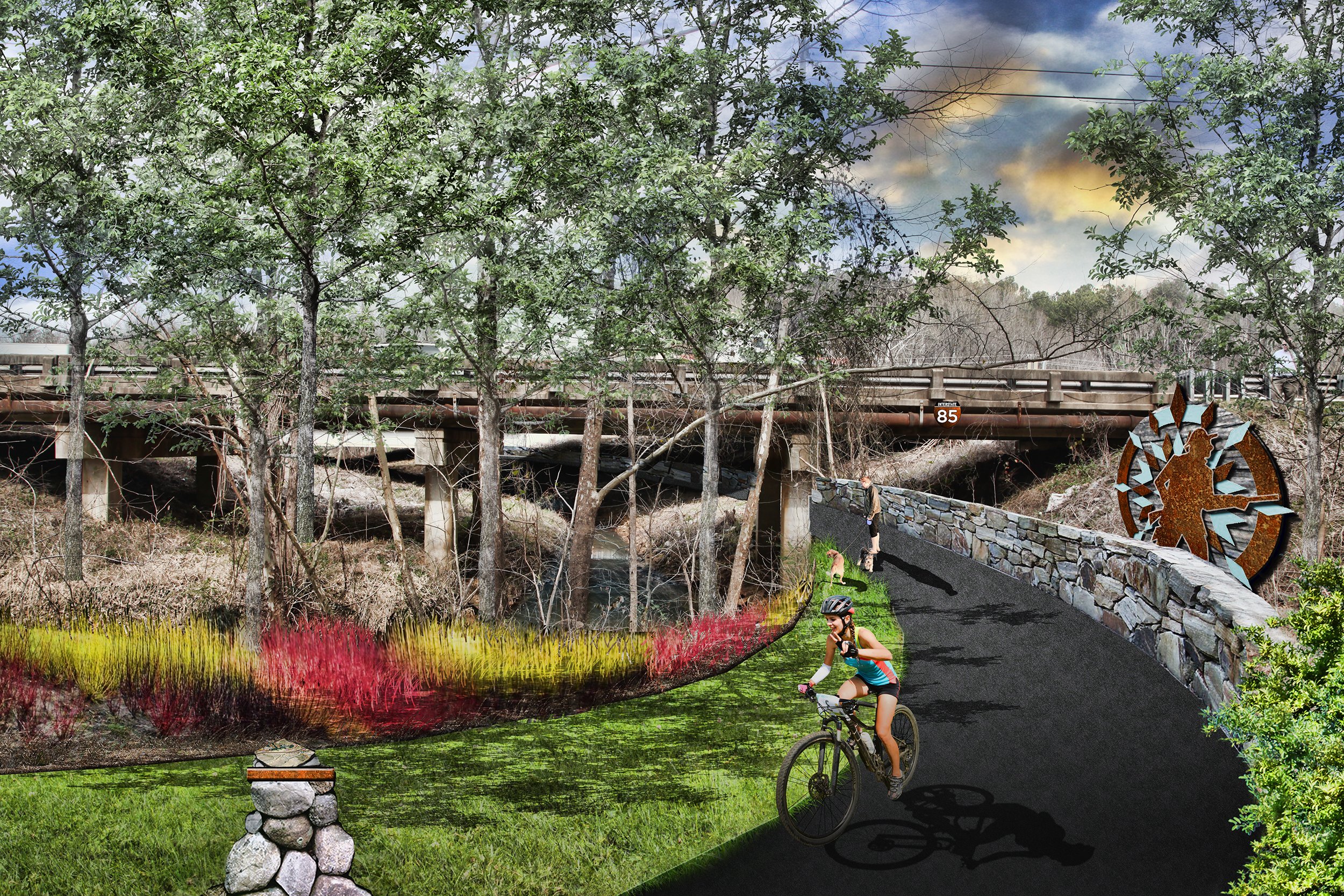
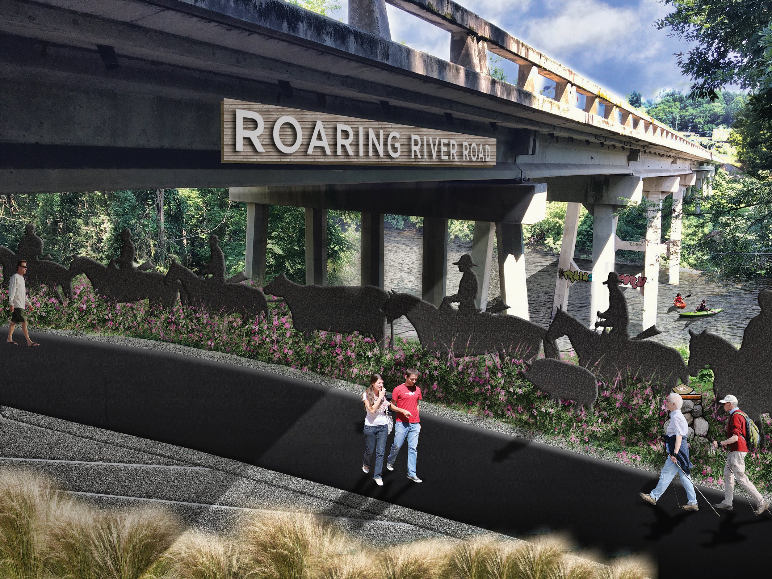
SECTION 6: Elkin to W. Kerr Scott Reservoir
Elkin offers an almost unmatched level of convenience for the modern-day outdoor enthusiast. The town is just 15 minutes from Stone Mountain State Park and about 20 minutes from the entrance to the Blue Ridge Parkway. The town is also overflowing with trail systems, including the Mountains-to-Sea Trail, Yadkin River Blueway, and an array of local trails.
The planned 28-mile stretch of the OVNHT from Elkin to W. Kerr Scott Reservoir will add another layer of trail connectivity to the Elkin area. The trail will connect downtown Elkin to the W. Kerr Scott Reservoir, a popular outdoor destination in the Wilkesboro area. Serving as both a historical asset and outdoor recreational asset, the OVNHT stretch from Elkin to W. Kerr Scott Reservoir will be a perfect complement to the area’s existing trail networks.
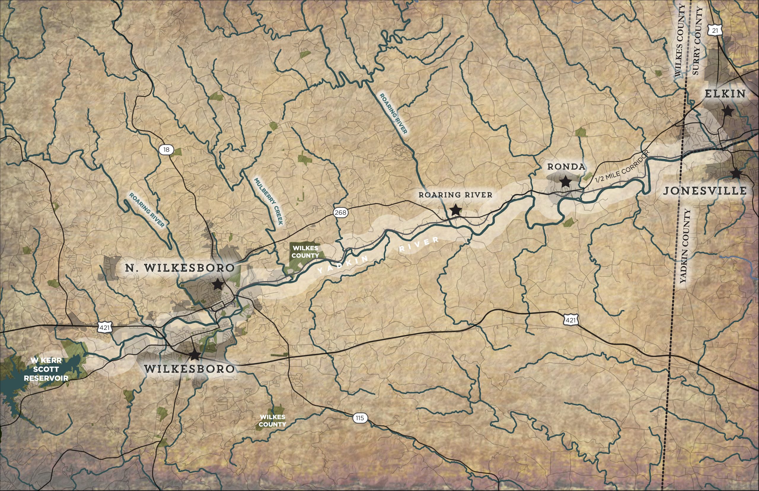
Read the Elkin to W. Kerr Scott Reservoir Section Plan

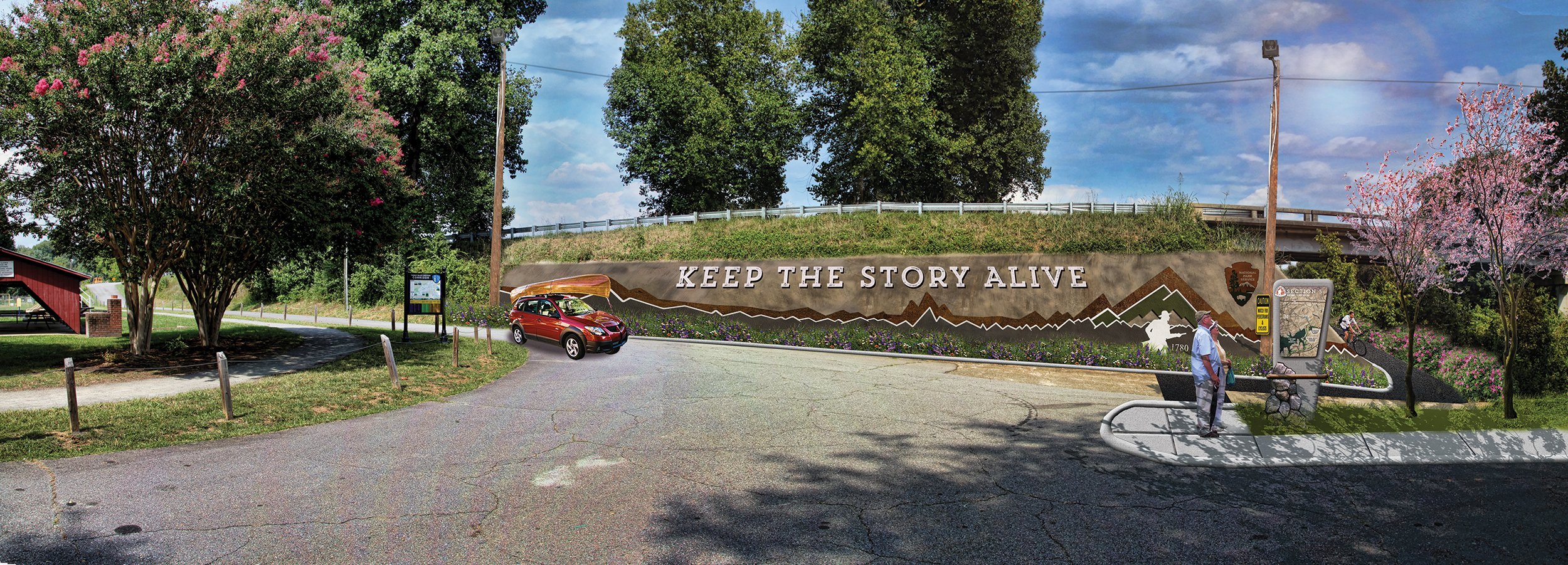
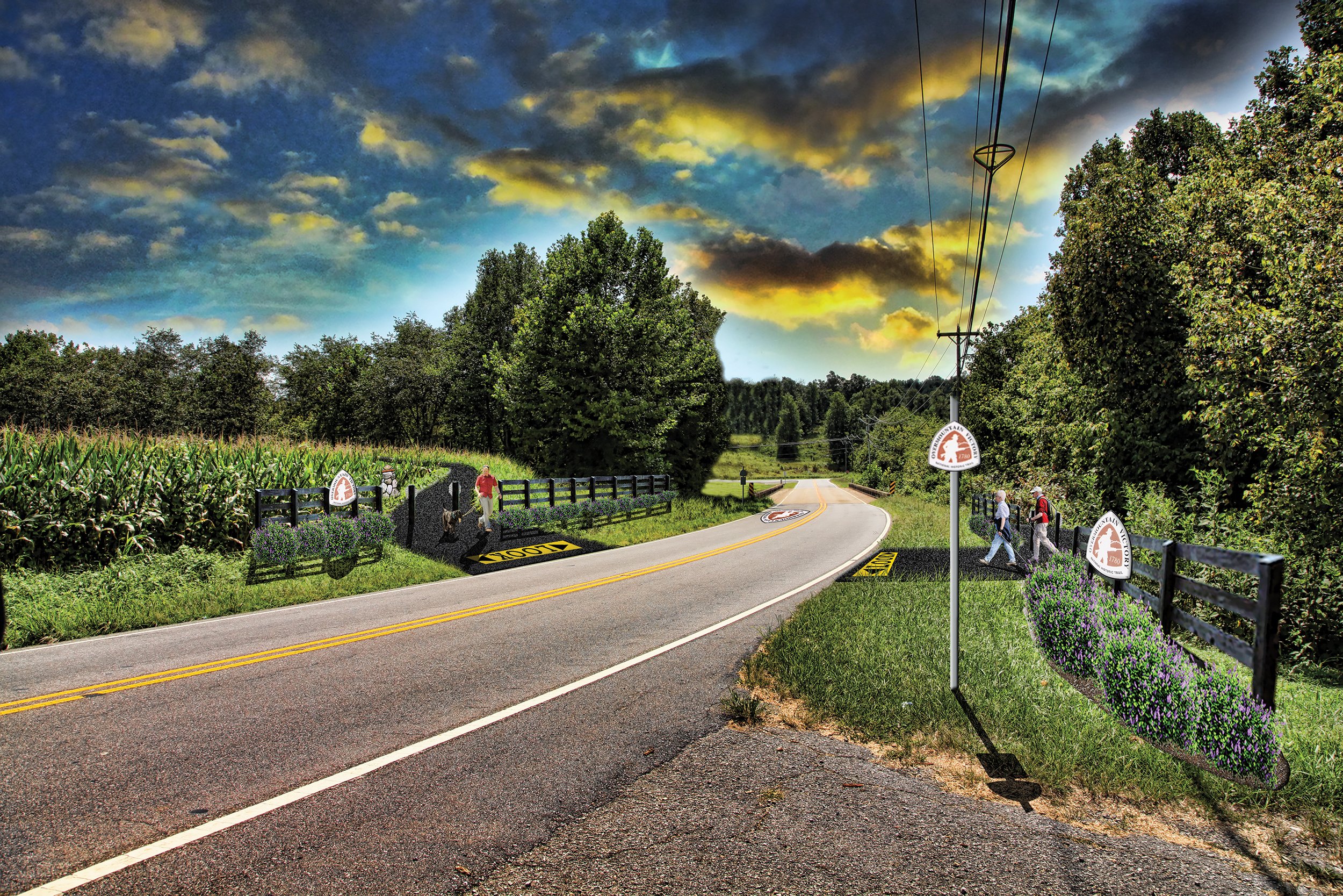
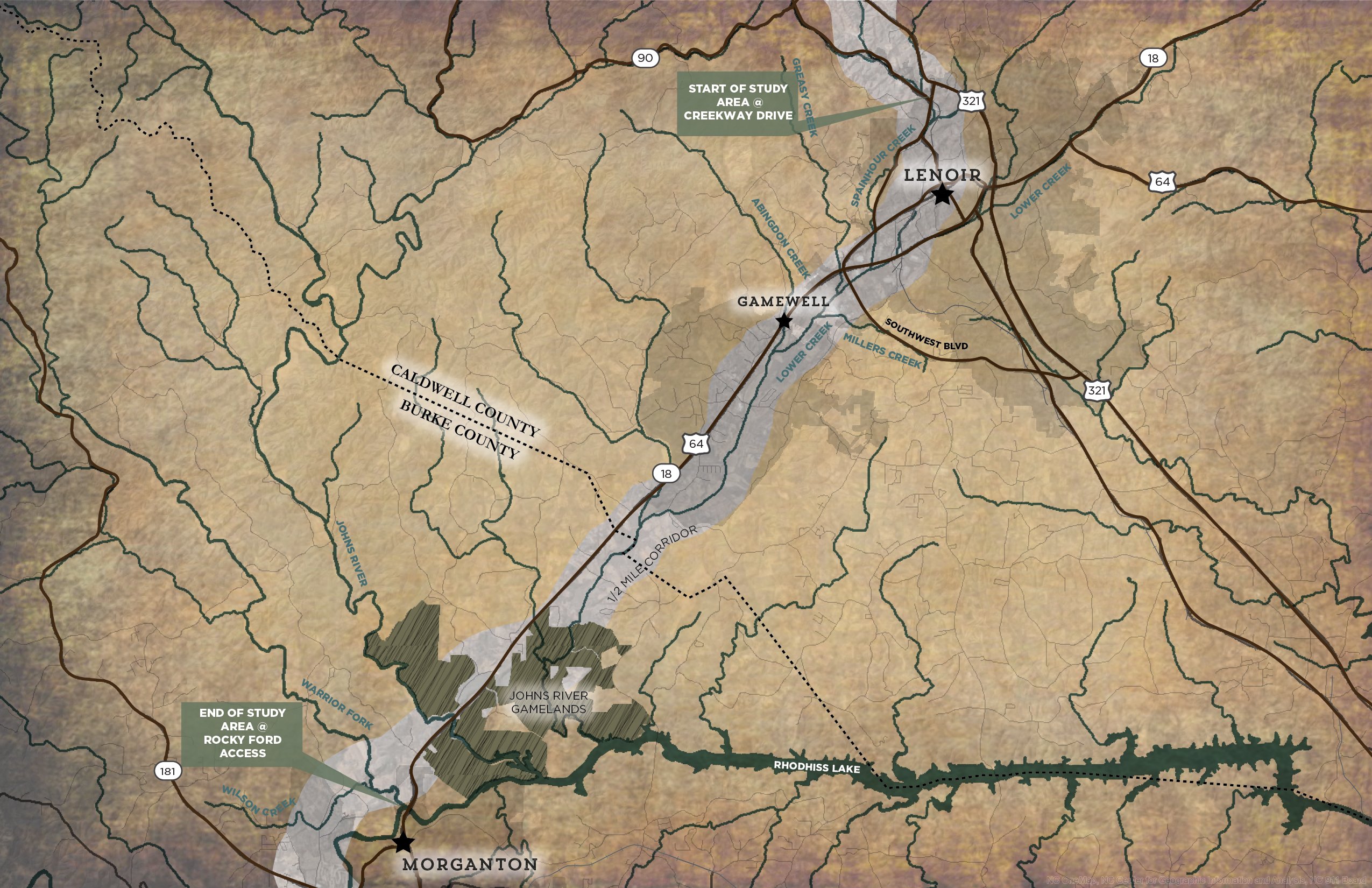
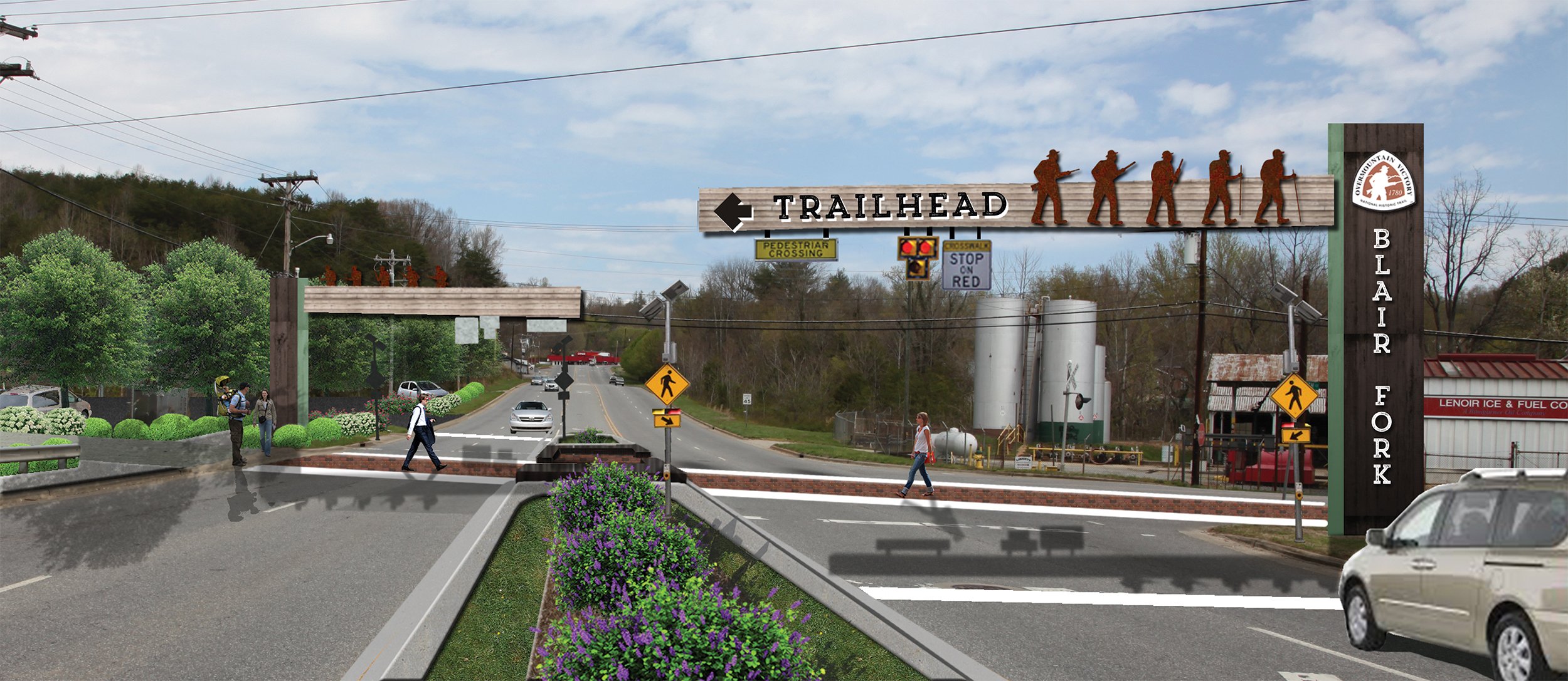
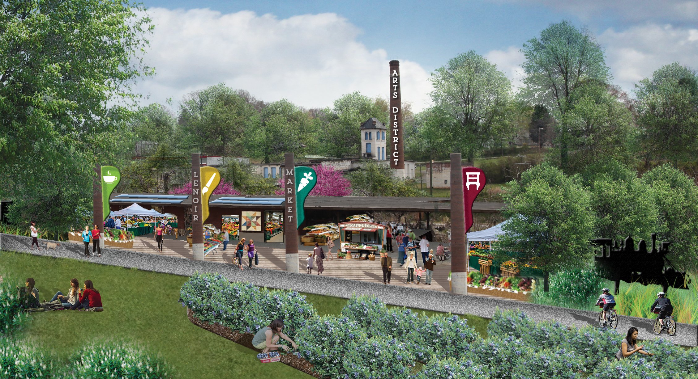
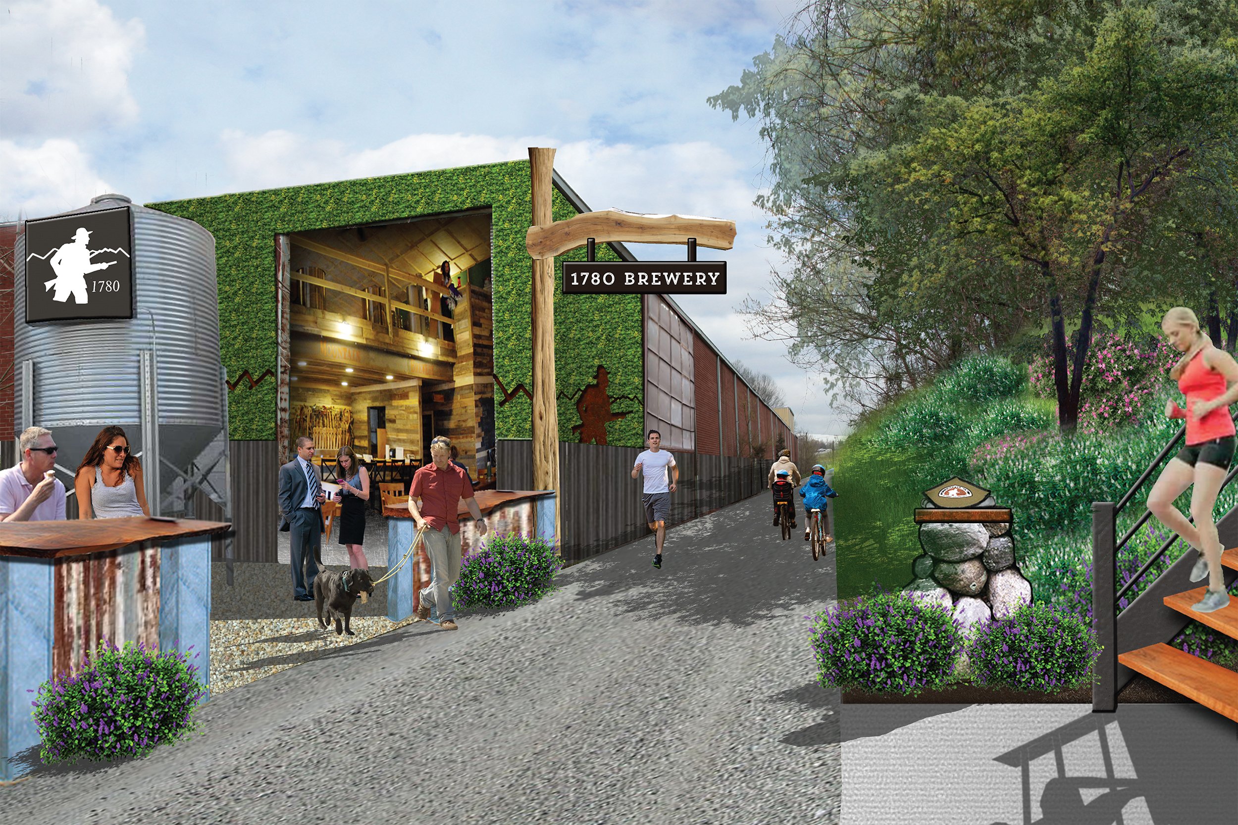
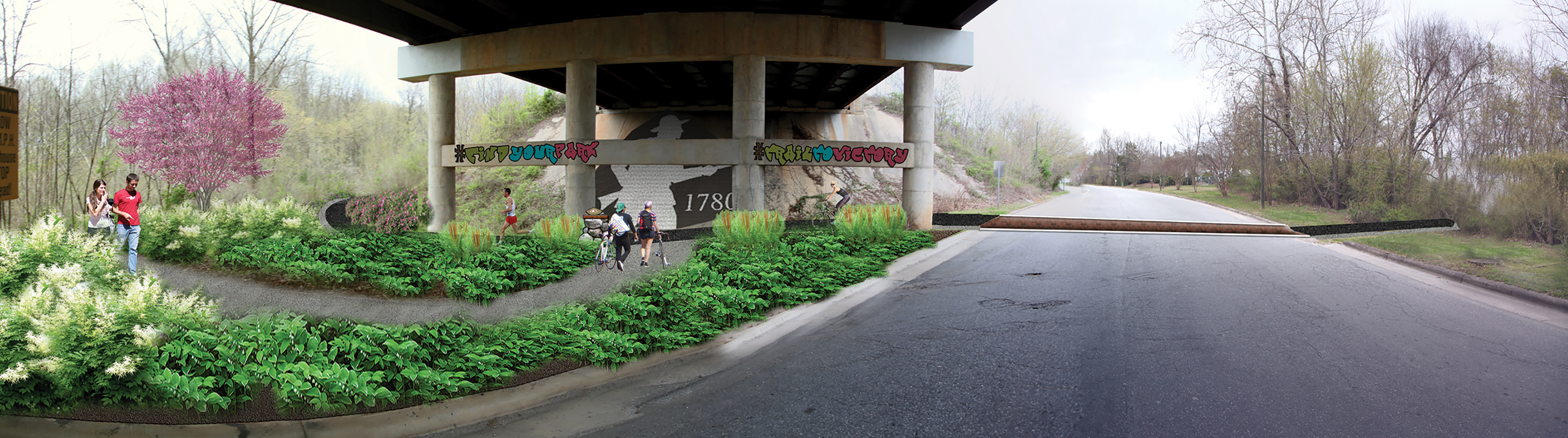
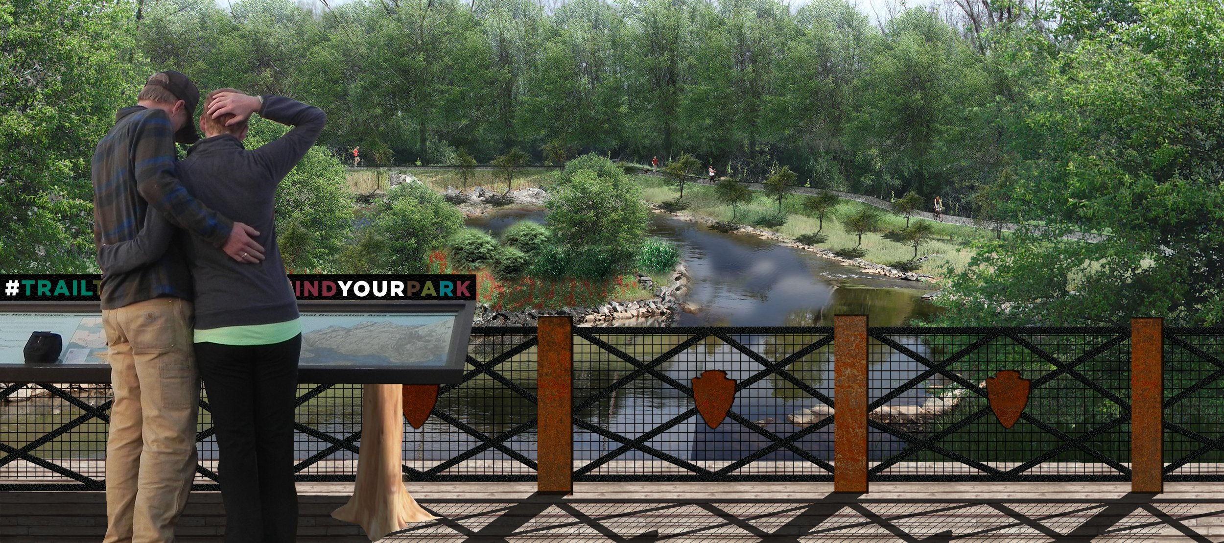
SECTION 7: Lenoir to Morganton
This planned section of the OVNHT traverses 20 miles, connecting two major population centers in the area. The trail will link regional points of interest like Fort Crider, the Lenoir Greenway, Unity Park, and Johns River Game Lands. The planned trail will also complement existing community plans and put wind in the sails of ongoing community revitalization efforts, especially in and around downtown Lenoir, NC.
Read the Lenoir to Morganton Section Plan
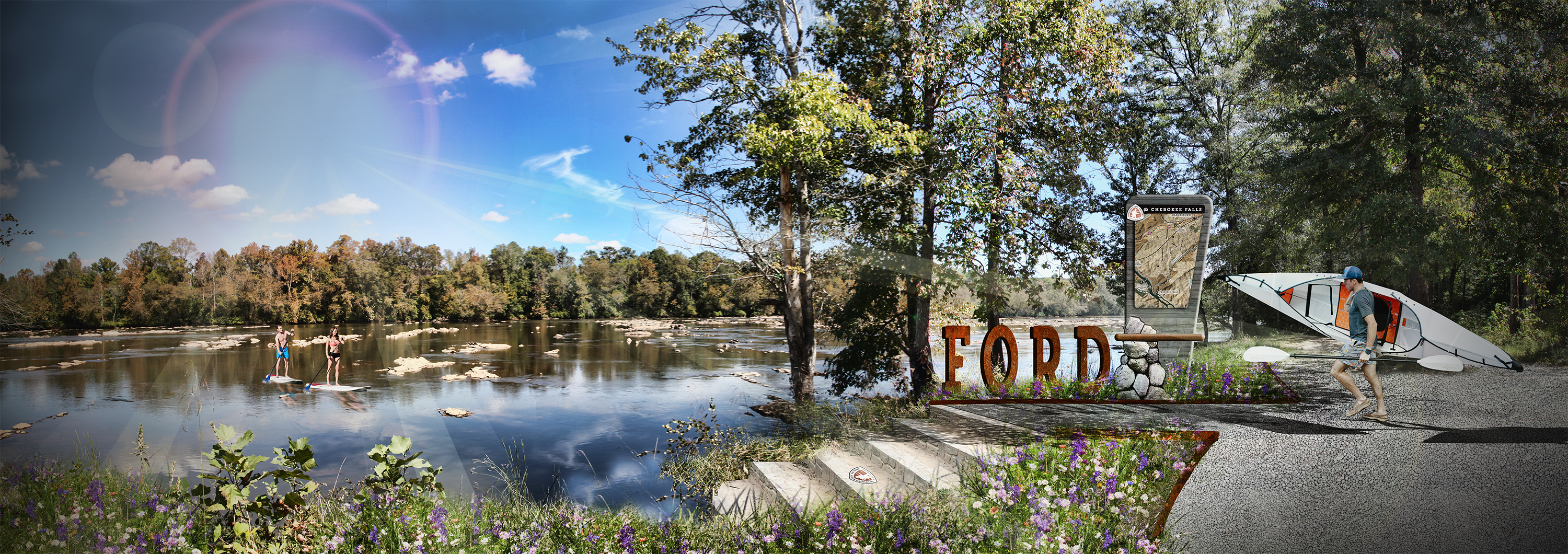
Section 10: Chesnee to Kings Mountain
This 74-mile planned stretch of the OVNHT will help draw history buffs to the Kings Mountain National Military Park, the site of the famed battle between the Patriot militiamen and British-led forces. The trail will benefit from its planned connections to the downtowns of the City of Chesnee, City of Gaffney, and Town of Blacksburg. Each community’s downtown core provide a solid foundation of built environment assets that can anchor the OVNHT and help to spur additional public and private investments along the trail corridor.

Read the Chesnee to Kings Mountain Section Plan